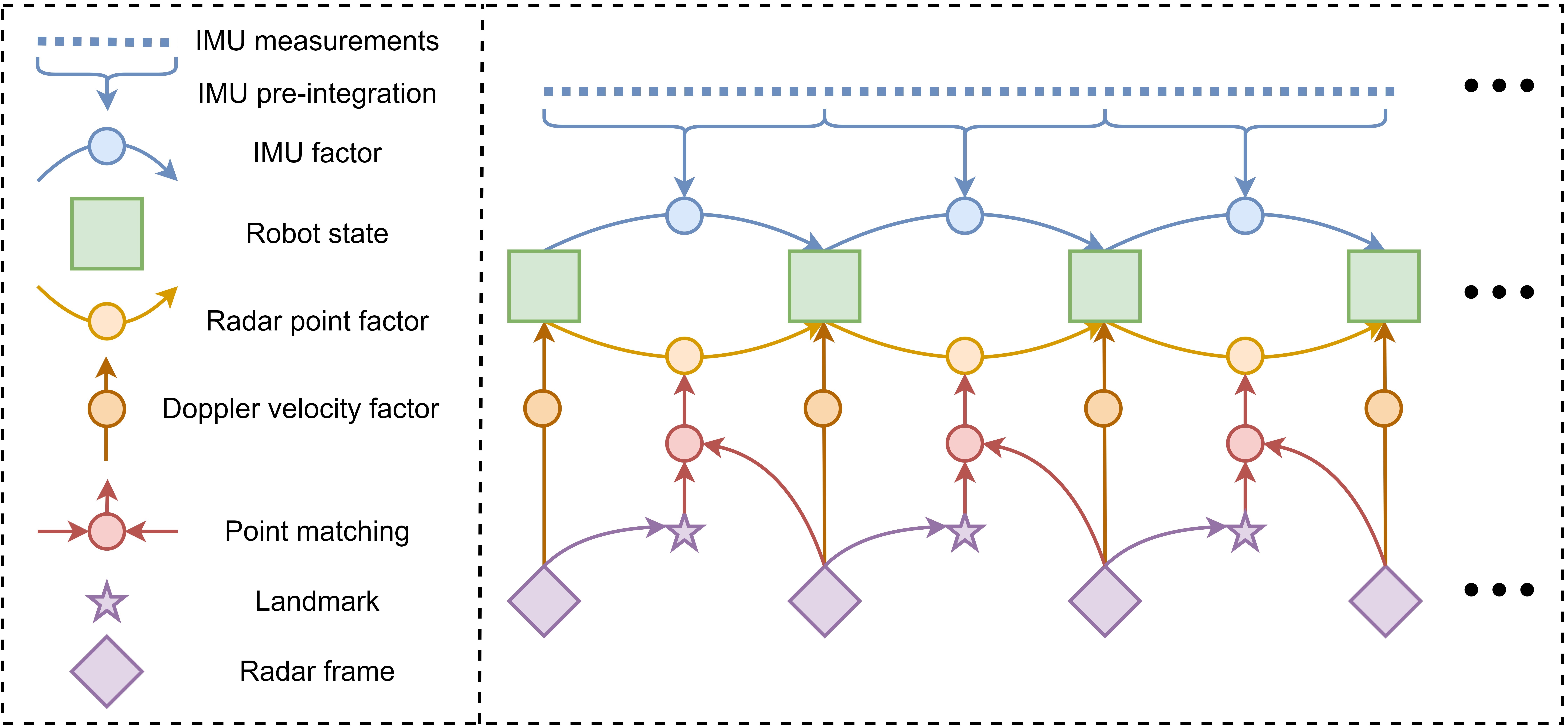
Optimization Based and Point Uncertainty Aware Radar-inertial Odometry for 4D Radar System
Please refer to the docker/Dockerfile for the detailed dependencies.
./docker/docker.sh -b # build the docker image
./docker/docker.sh -r # run the docker container# Allow the docker container to connect to the X server
xhost +# In the first terminal
roscore &
rviz # config file: rio/config/RIO.rviz
# In the second terminal
cd /ws
catkin_make
# Run the RIO with the sample dataset
python3 /ws/src/docker/run.py -a -n rio -c /ws/src/rio/config/ars548.yaml -d /ws/src/dataset/exp/Sequence_1.bag -r 1 -p 1Then you can see the odometry and the point cloud in rviz.
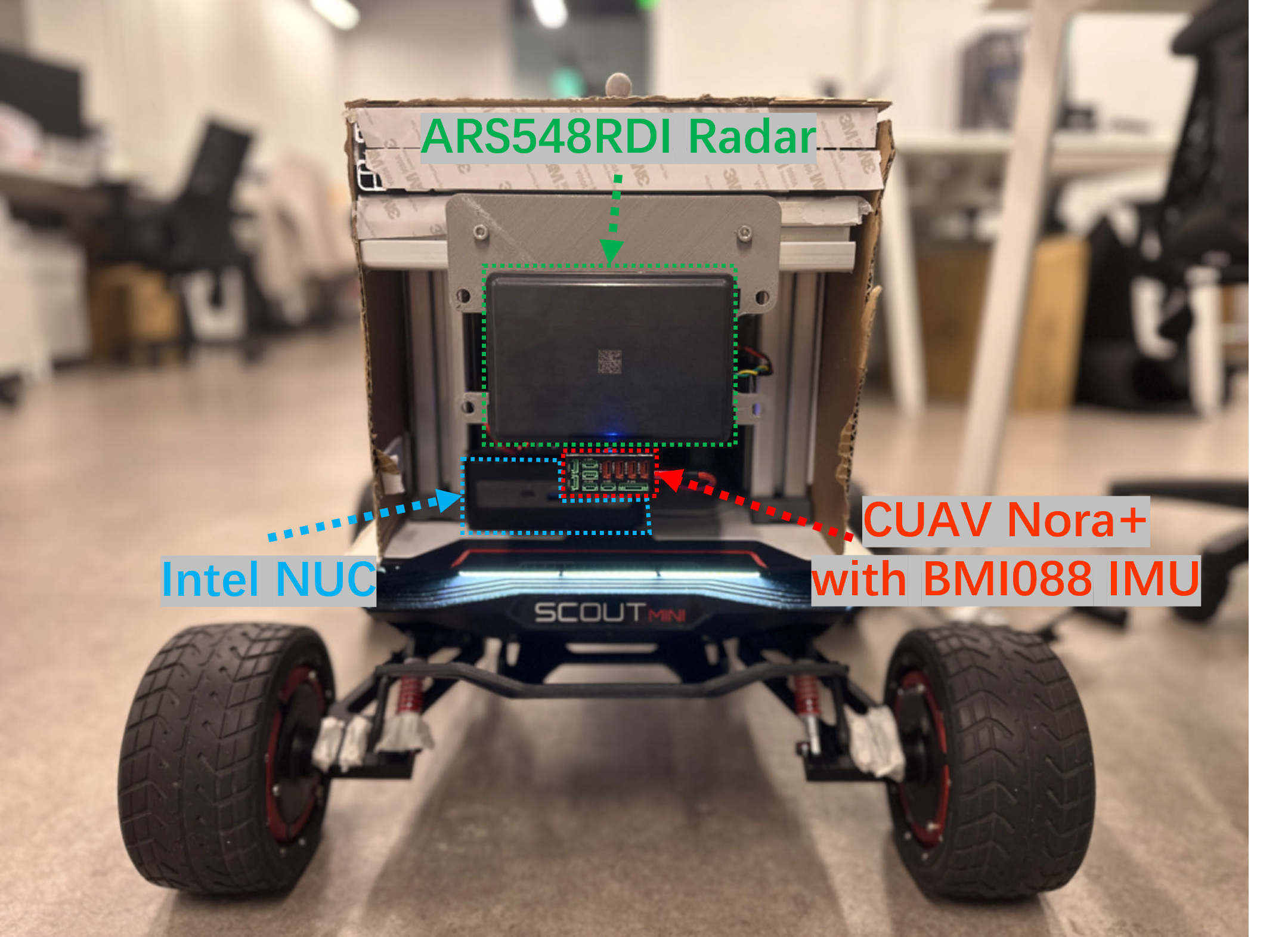
Our platform consists of a 4D FMCW Radar ARS548RDI manufactured by Continental and an IMU BMI088 manufactured by Bosch. The radar sensor is mounted on the front of the platform, while the IMU is mounted on the bottom.
Red trajectory is the proposed full system. Blue one is the system without point uncertainty model, and black one is the ground truth trajectory. We present the results on four sequences in two different datasets.
-
Sequence 1 : involved relatively low-speed movements.
-
Sequence 2 : involved relatively high-speed movements.
-
Sequence 3 : involved relatively high-speed movements with high-speed rotations.
| Field Name | Data Type | Count | Offset (Bytes) | Remarks |
|---|---|---|---|---|
| azimuth | sensor_msgs::PointField::FLOAT32 |
1 | 0 | Angle in the horizontal plane |
| azimuthSTD | sensor_msgs::PointField::FLOAT32 |
1 | 4 | Standard deviation of azimuth |
| elevation | sensor_msgs::PointField::FLOAT32 |
1 | 8 | Angle in the vertical plane |
| elevationSTD | sensor_msgs::PointField::FLOAT32 |
1 | 12 | Standard deviation of elevation |
| range | sensor_msgs::PointField::FLOAT32 |
1 | 16 | Distance to the target |
| rangeSTD | sensor_msgs::PointField::FLOAT32 |
1 | 20 | Standard deviation of range |
| velocity | sensor_msgs::PointField::FLOAT32 |
1 | 24 | Speed of the target |
| velocitySTD | sensor_msgs::PointField::FLOAT32 |
1 | 28 | Standard deviation of velocity |
| rcs | sensor_msgs::PointField::INT8 |
1 | 32 | Radar cross-section |
It consists of 52 sequences, recorded in mines, built environments, and in an urban creek path, totaling more than 145 minutes of 3D FMCW radar, 3D lidar, and IMU data. The full dataset, including sensor data, calibration sequences, and evaluation scripts. It is available at ColoRadar.
If you find our work useful in your research, please consider citing:
@article{huang2024morephysicalenhancedradarinertialodometry,
      title={Less is More: Physical-enhanced Radar-Inertial Odometry},
      author={Qiucan Huang and Yuchen Liang and Zhijian Qiao and Shaojie Shen and Huan Yin},
      booktitle={ICRA},
      year={2024},
}@misc{xu2024modelingpointuncertaintyradar,
title={Modeling Point Uncertainty in Radar SLAM},
author={Yang Xu and Qiucan Huang and Shaojie Shen and Huan Yin},
year={2024},
eprint={2402.16082},
archivePrefix={arXiv},
primaryClass={cs.RO},
url={https://arxiv.org/abs/2402.16082},
}MIT License (see LICENSE).


