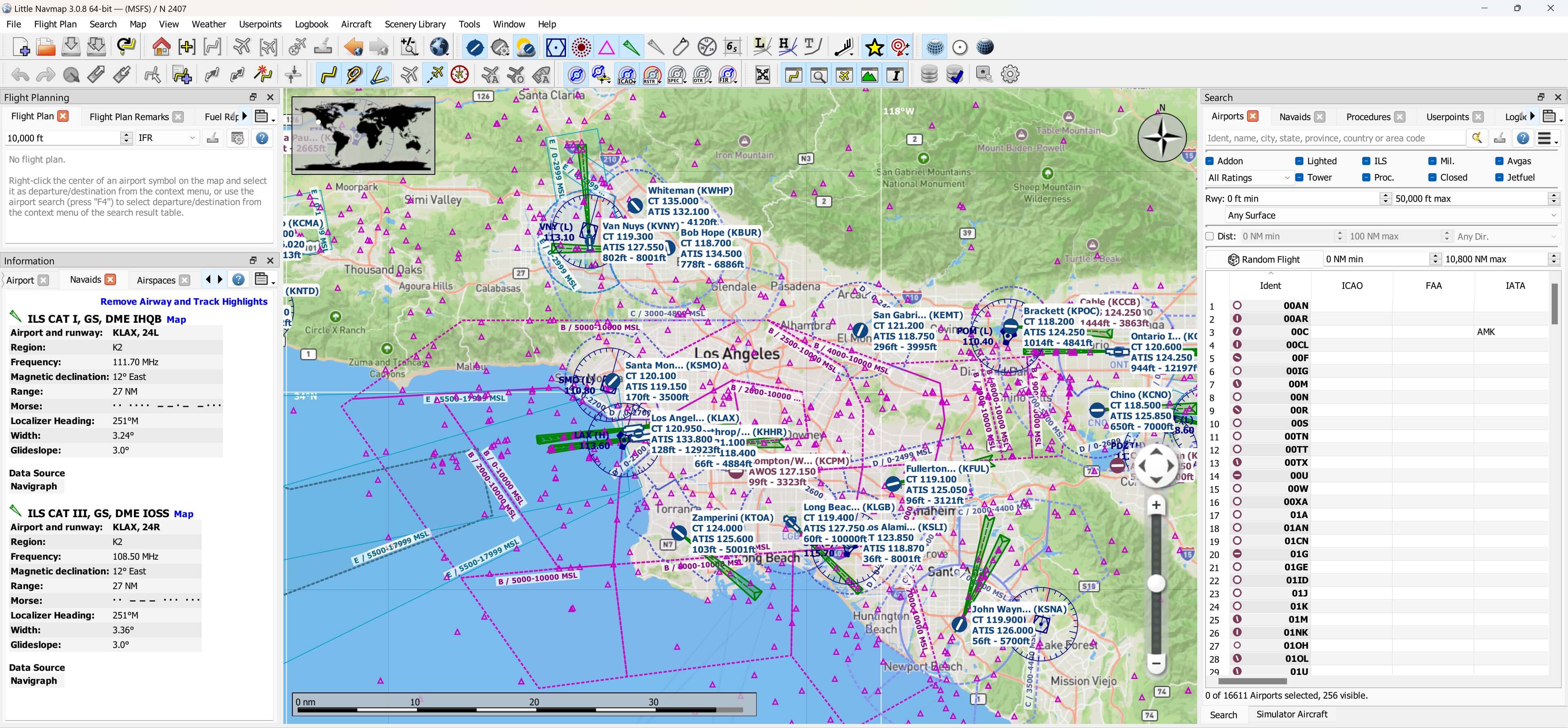
This repo includes many custom maps for Little Navmap 3.x.x:
- Google Maps (Default)
- Google Maps (Satellite)
- Google Maps (Terrain)
- Mapbox Streets
- Mapbox Outdoors
- Mapbox Light
- Mapbox Dark
- Mapbox Satellite
- Mapbox Satellite Streets
- Mapbox Navigation Day
- Mapbox Navigation Night
- Amap Streets
- Amap Satellite
- U.S. VFR Sectionals
- U.S. IFR Enroute Low
- U.S. IFR Enroute High
- U.S. IFR Area Charts
- U.S. Terminal Area Charts (TAC)
- U.S. Helicopter Route Charts
- Norway Topographic Maps
- Sweden Topographic Maps
- Finland Topographic Maps
- Open Street Maps
- Open Flight Maps
- Arcgis
- IGN Géoservices
To use the maps:
-
make sure Little Navmap is closed.
-
drop the 'data' folder inside the zip-file into the root Little Navmap folder, overwrite when asked.
-
run Little Navmap and select one of the above maps from the drop-down menu 'Select map theme' located at the top right corner above the Map window.
Enjoy!
https://www.avsim.com/forums/topic/548994-new-maps-for-lnm/
https://flightsim.to/file/6411/map-extensions-for-little-navmap-lnm
https://flightsim.to/file/13899/littlenavmapofmtheme
https://www.bilibili.com/video/BV1xP4y1A7Ky
albar965/littlenavmap#479 (comment)
https://docs.mapbox.com/api/maps/styles/
Thanks for Cloudflare worker
Porxy Script:
addEventListener(
	"fetch",event => {
		let url=new URL(event.request.url);
		url.hostname="tiles.satellite.image";
		let request=new Request(url,event.request);
		event. respondWith(
			fetch(request)
		)
	}
)
More charts please visit https://taxiway.uk/charts/
